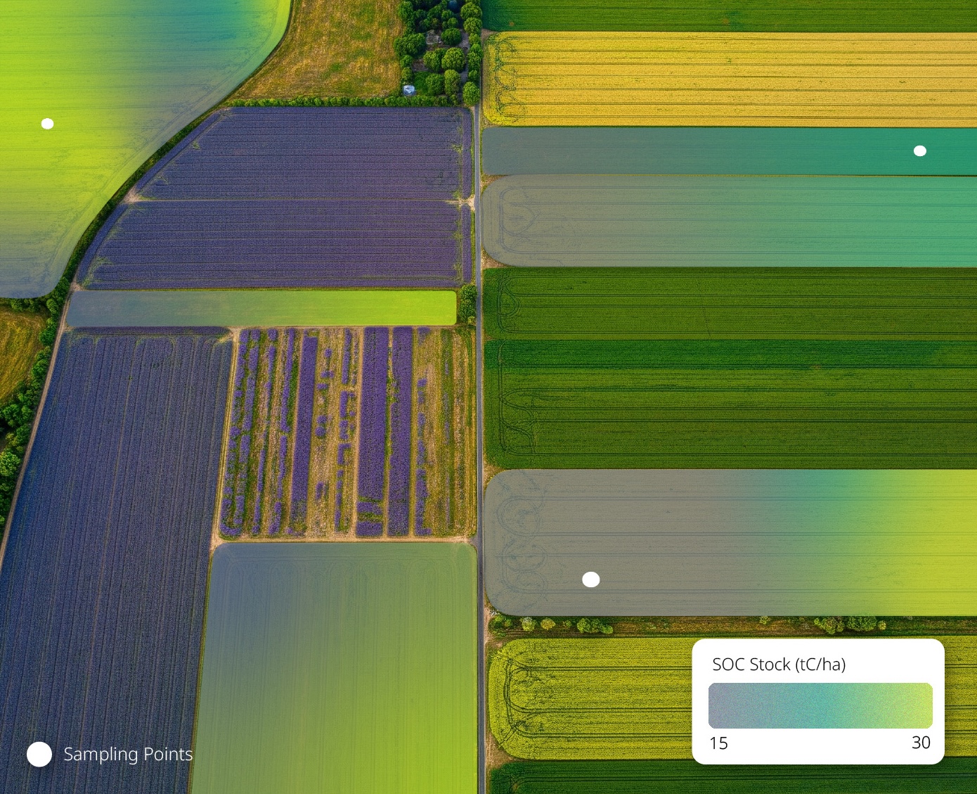


Enabling Soil Carbon
Capture At Scale
We help our partners meet the growing demand for carbon offsets and support the transition to regenerative agriculture.
Our MRV (monitoring, reporting, and verification) tools will make measuring your soil carbon 10x cheaper and 60x faster.
Trusted by
Trusted by:


Our Services
Seqana is at the cutting edge of satellite-enabled ecosystem monitoring. While our comprehensive MRV system is still in development, there are a few services that we already offer to make your life easier today.
Project Origination
Stratification and Sampling Planning
Degradation Analysis


Deep Research
The core of Seqana's mission is to build scalable and integrated MRV tools that quantify the environmental impact of a project through a carbon lens. Features of our platform will include:
Global replicability of MRV results
10x cheaper than current MRV solutions
60x faster than current MRV solutions
Markets That Scale
Seqana is building the tools for a scalable natural climate solutions (NCS) market. We envision a world where farmers in established and developing markets are compensated for their environmental stewardship.
570 million farms will benefit
100+ gigatons of carbon will be sequestered
Biodiversity and ecological health will be returned to ecosystems

Who is Seqana ideal for?

Developers and auditors of soil carbon projects
Origination, stratification, and cost-efficient MRV services to issue offsets

Agrifood value chain
companies
Planning and monitoring for insetting initiatives

Farming and
agriculture platforms
APIs with Soil Carbon data streams
Need soil carbon data?
Whether your company is developing new projects or expanding existing ones, access to high quality data is key.
Contact us to explore collaboration opportunities!
Frequently asked questions
We believe soil carbon and soil health to be some of the most important tools in the toolbox to combat climate change and support many of the sustainable development goals. We provide both scale and scientific rigor to the monitoring, reporting, and verification of soil carbon projects.
Our machine learning algorithms utilize public, commercial, and private datasets to create cutting-edge models. The types of data can generally be categorised as satellite imagery, environmental data, and soil carbon samples.
Together with the registries and in close collaboration with the scientific community, we are developing comprehensive, scientifically rigorous methods to measure and verify our models' accuracy - something our nascent industry unfortunately still lacks.
We have hundreds of thousands of data points from our partner network around the world. We also conduct our own targeted sampling campaigns to strategically improve our regional algorithms' performance where necessary.
Our analytics are currently being used in 10 countries around the globe. Our primary focus is in Europe, North America, and Africa. We also have ongoing collaborations in South-East Asia, South America and Australia.
Still have questions?
Feel free to reach out to one of our expert team members. We will contact you as soon as possible.
Case studies
Lorem ipsum dolor sit amet, consectetur adipiscing elit.